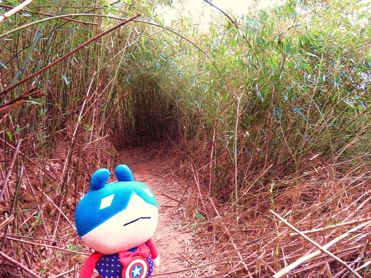
**** Want to chat with Captain Amerika? You can find him by clicking the chat-bot at the bottom of this article, or the bottom right corner. You can talk to him (English only) anytime you like, but as he is still not get used to talking to human, sometimes you may find his replies very nonsense....... but anyway, this is Captain's style.... don't be angry / annoyed.
坐擁四城奪鉛礦 上達草山降沙田
(大城石澗, 肥佬麥, 鉛礦坳, 四城石澗, 草山)
Big Challenge from Lung Mun Country Trail to Tiger Trail, Tai Shing Stream, "Fat Guy Mak" Rock, Lead Mine Pass, Grassy Hill and finally down to Shatin
(荃灣地鐵站→兆和街小巴總站 82號→城門水塘→畔塘徑→龍門郊遊徑→鉛礦坳方向→虎踪徑→鉛礦坳方向→大城石澗→肥佬麥→跨越大城石澗→南房肚廢村→竹林→鉛礦坳方向→城門林道--大城石澗段 [四城石澗]→鉛礦坳營地→大埔滘方向→往草山折徑→草山→針山方向→針草坳→沙田郊野徑→道風山路→沙田火車站)
(Tsuen Wan MTR station→Minibus terminus @ Shiu Wo Street for minibus no. 82→Shing Mun Reservoir→Reservoir Walk→Lung Mun Country Trail→The direction for Lead Mine Pass→Tiger Trail→The direction for Lead Mine Pass→Tai Shing Stream→Big Rock "Fat Guy Mak"→Cross Tai Shing Stream→Nam Fong To Village [abandoned]→Bamboo forest→The direction for Lead Mine Pass→Shing Mun Forest Track--Tai Shing Stream Section [Sei Shing Streams]→Lead Mine Pass Campsite→The direction for Tai Po Kau→Short-cut for Grassy Hill→Grassy Hill [hilltop]→The direction for Needle Hill→Shatin Country Trail→To Fung Shan Road→Shatin Railway Station)
Album:
http://www.fotop.net/medalene/19jan19FatGuyMakRock?page=1
http://www.fotop.net/medalene/19jan19FatGuyMakRock?page=2
http://www.fotop.net/medalene/19jan19FatGuyMakRock?page=3
http://www.fotop.net/medalene/19jan19FatGuyMakRock?page=4
https://medalene.blogspot.com/2019/01/20190119-fatguy-mak-rock.html
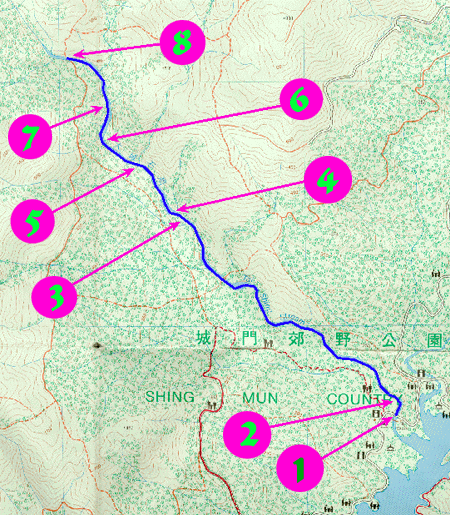
今天所使用的地圖, 最左面的紅色線, 便是今日所走之路.
Here's the map we used today.
The RED line at the left is the route we took, you can also see Tai Shing Stream.


再來.
We are here again.

龍門天梯.
Staircases challenge.


今回走向鉛礦坳.
This time we are going to Lead Mine Pass.

走向鉛礦坳的山徑, 又名 "虎踪徑", 昔日曾有老虎在此地出沒.
The hiking trail for Lead Mine Pass is also called "Tiger Trail".
Tiger was found in this area before the construction of Shing Mun Reservoir.

禾秧山
Mt. Wo Yeung Shan.


"虎踪徑" 內有大量溪澗, 非常濕滑, 危機四伏, 各位勿在潮濕或雨季時到來.
You have to walk through several streams @ Tiger Trail.
The rocks are very slippery, and floods are frequent during spring and summer.
For your own safety, come during the dry season.

終於走到大城石澗, 這裡高度約 500米, 是石澗的上源, 水流十分急.
下面地圖的 8 號位置, 就是現在身處之地.
http://www.hkadventurer.com/taishing/map.gif
Finally we are @ Tai Shing Stream.
We are @ the upper part of it, the height is approx. 500 metres, with fast-flowing stream water and slippery rocks everywhere.
The link below is showing the map of this place, we are at no. 8, the upper part of the stream.
http://www.hkadventurer.com/taishing/map.gif

要繼續前往鉛礦坳, 就要跨越大城石澗.
這裡沒有橋, 要踏著大石過河.
今天很乾燥, 天氣十分好, 我們很順利便抓緊岩石渡河.
若天氣不穩, 濕度高的日子, 相信水流會更急, 更危險.
To continue with the walk to Lead Mine Pass, you have to cross Tai Shing Stream.
NO bridges @ this place, you have to go down to the water and climb over the rocks
Better NOT to come for this place when it is humid or misty, floods are frequent during spring or summer, fatal accidents may occur when it is rainy.
Play SAFE!!!


著名景點, 巨石 "肥佬麥"!!!
自 70年代, 巨石 "肥佬麥" 已經廣為行山人士所聞, 今日終於有幸一吻這位 "大肥佬"!!!!
至於誰是 "肥佬麥"??? 到今天仍是一個謎!
亦有簡稱為 "肥麥石"
This may be the most famous rock in HK, especially among the hikers / stream-climbers.
The rock is called "Fat Guy Mak" or "Fat Mak Rock" (with Chinese characters 肥佬麥 painted on it).
Hikers found this rock in the 1970s and this place is called "Fei Lo Mak" in Cantonese (Thanks to the "Fat Guy Mak" rock), but you can NEVER find this name on the maps!!
BTW, who is "Fat Guy Mak"??
Who had painted those Chinese characters "肥佬麥" on the rock????
God knows...... till this moment, no one knows who "Fat Guy Mak" is.....


仍看到 "肥佬麥" 嗎??
Can you find out "Fat Guy Mak" from here?

南房肚廢村遺跡
Nam Fong To Village relics.
There are villages @ this place before the construction of Shing Mun Reservoir, in the 1930s.


走完山徑, 安全到達 "城門林道--大城石澗段", 車路很安全.
由於山路崎嶇不平, 又花了不少時間跟 "肥佬麥" 玩, 我們花了 2小時才到此地.
Leaving the bumpy mountain trail, now we are @ the traffic road.
This is Shing Mun Forest Track - Tai Shing Stream Section.
We have spent 2 hours in the mountain trail.


"城門林道--大城石澗段" 下山, 途中經過 "四城石澗"
"四城石澗" -- 水源從四方山來, 往下流至城門水塘.
There is a few streams along Shing Mun Forest Track - Tai Shing Stream Section.
People call them "Sei Shing Streams", the upper stream is @ Sei Fong Shan, a peak next to Tai Mo Shan, the lower stream ends @ Shing Mun Reservoir.

@ Lead Mine Pass.

走大埔滘方向
Go for Tai Po Kau.

往草山的折徑, 直接上草山山頂.
A short-cut for Grassy Hill, you can go upstairs for the hilltop from here.


草山山頂
The hilltop of Grassy Hill.


針山 Needle Hill.


針山方向走.
The direction for Needle Hill.

往沙田.
Going down for Shatin.


You can Add Captain Bot via LINE:
在 LINE 中加入米國隊長 bot bot:
沒有留言:
張貼留言