2012年2月18日

20120218-LoFuTauCountryTrail


勇闖東梅 踏老虎 (香港奧運徑+老虎頭郊遊徑)
A "Tiger-taming" walk ~~ Hong Kong Olympic Path & Lo Fu Tau Country Trail (==Tiger's Head Country Trail)
(東涌巴士總站36號巴士→香港奧運徑→白芒村→牛牯塱→大壕村→紅花顏→阿婆塱→老虎頭郊遊徑→返回望渡坳→梅窩→回市區)
(Tung Chung Bus Terminus for NLB bus no. 36→HK Olympic Trail→Pak Mong Village→Ngau Kwu Long Village→Hung Fa Ngan→Ah Por Long→Lo Fu Tau Country Trail→Back to Mong To Au→Mui Wo→Back to Central by ferry)

Album:

http://www.fotop.net/medalene/18feb12LoFuTau?page=1

http://www.fotop.net/medalene/18feb12LoFuTau?page=2

http://www.fotop.net/medalene/18feb12LoFuTau?page=3

http://www.fotop.net/medalene/18feb12LoFuTau?page=4

http://www.fotop.net/medalene/18feb12LoFuTau?page=5

http://www.fotop.net/medalene/18feb12LoFuTau?page=6

http://www.fotop.net/medalene/18feb12LoFuTau?page=7

http://medalene.blogspot.com/2012/02/lo-fu-tau-country-trail-2012.html


今早乘36號巴士, 於白芒村外下車. 36號巴士毎天只有3次從東涌巴士總站開出, 幾乎所有的乘客都是東梅古道內的村民!!
下車後在美麗的大蠔灣前留影, 再從"香港奧運徑" 出發, 向梅窩方向前進.
從巴士上看到, 由白芒開始的翔東路至富東街一段路已全加上了行人專用的地台, 以後應該可以直接從東涌步行過來, 不需再在馬路上走了吧?! (大約步行40-50分鐘)

J

We took NLB bus no.36 from Tung Chung Bus Terminus.
There are ONLY 3 times per day for Bus no. 36 to start from Tung Chung, and most of the passengers are the villagers living in Tung (=Tung Chung) Mui (=Mui Wo) Ancient Path (now as HK Olympic Trail).
We got down @ Tai Ho Bay, and we started from the sign "Hong Kong Olympic Trail", for the way to Mui Wo.
I could see that the maintenance work for the pavement along Cheung Tung Road (the part from HK Olympic Trail to Fu Tung Street), now is nearly completed,
in the future, we can walk from Tung Chung MTR to Pak Mong directly, and safely also, within 1 hour.
(In 2009, we needed to walk on the traffic road, with buses and trucks always passing by!!)


10分鐘光景, 已到了白芒村.

J

We reached Pak Mong Village in 10 mins.


15分鐘後, 便從白芒村步至牛牯塱村. 今早看到牛牯塱村內, 有很多村民在田地間與一堆村狗玩得很快樂, 村狗不停地在田間又叫又跳!

J

We walked for another 15 mins (from Pak Mong Village) to Ngau Kwu Long Village.
See the villagers and the dogs were playing in the fields, the dogs were barking and running happily.


上山再向梅窩方向走, 中途會路經在林內的大蠔新村 (閒人免進).

J

Going uphill for the way to Mui Wo, Tai Ho New Village is inside the woods (Do Not disturb, with lots of dogs inside).


走到山坡上有一小亭, 亦是 北大嶼山郊野公園(擴建部份) 的所在, 此地又名 "紅花顏".

J

UP and UP and then you can find a little pavilion @ the hilltop, this place is part of the North Lantau (Extension) Country Park.
It is called "Hung Fa Ngan" also.


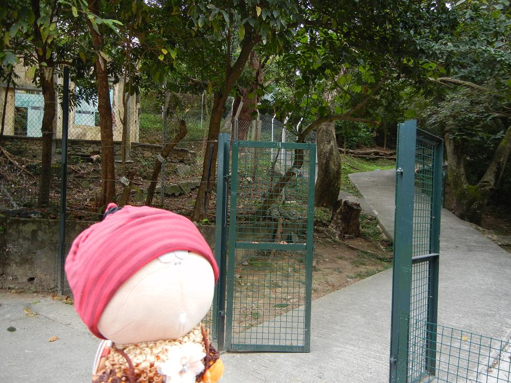
從"紅花顏"再上山, 很快便看到另一個小木亭, 此地古名叫 "阿婆塱", 今天則是"老虎頭郊遊徑" 的入口.
此郊遊徑是2011年才正式開放給行山人士使用, 昔日此地全是一片叢林荒野, 要登山有點危險.
現在雖然路上沙石亦甚多, 但要登上老虎頭的頂部, 已較昔日容易得多了. (但要小心山坡非常多散石, 很易滑倒.)

讓我們進去探一下!!! 山路的確很多沙石, 但山上的景色值90分!! 這裡常有人玩爬山單車, 速度很快, 小心"車禍".

J

Keep on walking uphill from Hung Fa Ngan, and then you will find another wooden pavilion. This place is called "Ah Po Long",
now also is the entrance of a new trail "Lo Fu Tau Country Trail" (=means Tiger's Head country trail), which was opened for hikers' use in 2011.
This trail was covered by bushes in the past, and it was quite dangerous to walk to the hilltop at that time.
Now it has become much easier for hikers to try reaching the top of "Tiger's Head", but you still need to take great care of the scattered stones and sand all over the trail,
especially when you are walking on slopes.

Let's go inside to have a look!!! Woow!! See how slippery the sandy trail is!!! But the mountain scenes worth 90 points!!!
And one thing is, there are lots of mountain bikers practising here, they will sudddenly "flying" down from the slopes.
Be careful when you are walking through this trail to avoid any unexpected "traffic accidents"!!


山路上的小型戈壁沙漠, 這裡其實亦是"望渡坳" 及老虎頭的交接地.

J

A mini "Gobi" desert @ the trail. Here is also in between "Mong To Au" and Lo Fu Tau.


這裡往下望, 便是愉景灣的高爾夫球場, 然後再踏上"戈壁沙漠", 繼續上山.

J

Looking down from the hillside, we could see the Golf course of Discovery Bay (DB)! Then we moved uphill again via Gobi Desert.


看"老虎頭" 給我們準備了豐富的早餐!! ~~ 三大片裸麥包!!! "吃" 過了裸麥包後, 再續走"戈壁沙漠", 向山上進發.

J

See what Lo Fu Tau had prepared for hikers! ~~ 3 big pieces of rye bread!!
After the BIG "breakfast", we continued our journey for "Gobi Desert", moving uphill again.


享受山風, 一樂也!!!

J

Gone with the wind!!! :D


報告隊長: 山坡上有火箭狀的怪石!!! 是外星人嗎??? 上山一看, 外星人的飛行器已變了三塊石頭.

J

Captain, is that a rocket from Aliens??? Let's go up and have a look first..... OH! The rocket turned into 3 pieces of rocks!!


怎麼有個巨型泳池???? 原來那是愉景灣水塘.

J

Oh, a jumbo swimming pool down there???? No, it is just the reservoir of Discovery Bay.


愉景灣那邊的大廈, 細小得像一件一件的玩具.

J

See the buildings of Discovery Bay, they now look like a pile of toys.


火車軌??? 那是北大嶼山公路.

J

Railroad on the water???? No, it is the North Lantau Highway.


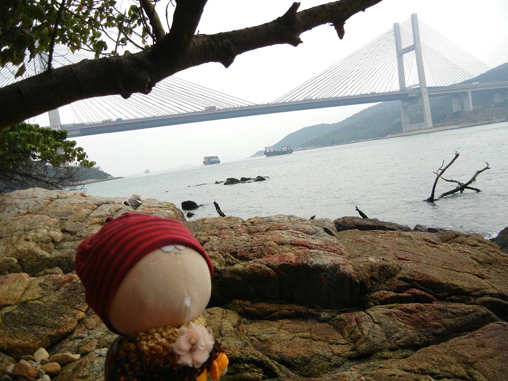
走了多段山路, 腳很痛, 不再上山頂看老虎的頭了.

J

Walked and walked uphill for a long time, my legs ached so much .... I had to quit from here, left the others going to the top of Tiger's Head.


終於遇上鼎鼎大名的 "仙桃石"!!! 這位 "桃姐"一直聞名於山友之間!! 連外地來的山友都說它非常特別, 來此地也會停下看一下.
相傳"仙桃石"是天界的神仙來此地遊玩時不小心留下來的!! :D

J

See this famous celestial peach @ Lo Fu Tau!!! Perhaps it is a celestial peach being left here by accident, when the fairies were having a party on Tiger's Head thousands of years ago!!
Hikers came here this morning also said that the peach is really amazing!!


仙桃的背面.

J

At the back of the peach.


下山時, 忍不住在黃金草原中玩樂一番, 又看看高爾夫球場內的一大片人工湖.

J

We were running near the Golden grassland, and also had a look @ the big artificial pond inside the golf club.


郊遊徑內大部份路段都是碎石.

J

Most of the trail is like this ~ stones scattered around.


狼來了???? 哈哈, 原來一隻雪橇犬從愉景灣走來了....

J

A mountain wolf here???!!! Hahaha!! Just a husky coming from Discovery Bay!!


望渡坳小亭及山頂的標高柱.

J

Now @ the rain shelter of Mong To Au, together with the geometrical pole at the hilltop.


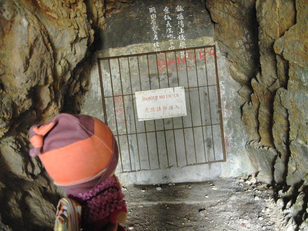
銀礦洞內採礦!!! (早已給封起來了.)

J

Silver-mining inside Silvermine Cave!! (Closed decades of years ago!!)


一探白銀鄉的文武廟

J

A visit @ Man Mo Temple of Pak Ngan Heung (A place famous of silver mining in the past)


下去梅窩碼頭, 會經過橫塘村及涌口村.

J

The way (downstairs) for Mui Wo Ferry Pier, via Wang Tong Village and Chung Hau Village.


橫塘村內的新式村屋, 村民甚多.

J

Lots of residents are living in Wang Tong Village.


經濟不景, 孖寶兄弟之一的他, 也放下身段來港工作, 成為全職稻草人.

J

Due to the global economic crisis, Super Mario Bros also came to HK for more opportunities~ now he has become a full-time Scarecrow!!


可愛的狗!!!!

J

What a lovely dog!!

2012年2月11日

20120211-RoundTheIslandWalk-MaWanIsland


馬灣環島遊
Round the Island visit @ Ma Wan Island (Park Island)

(葵芳地鐵站→新都會廣場穿梭巴士站→馬灣穿梭巴士→馬灣→東灣海灘→土地公角→麒麟石[公仔灣]→大嶺頭墓園→大排咀海岸[南灣+龍蝦灣]→馬灣大街→馬角咀→漁民村→馬灣大街村→北灣)
(Kwai Fong MTR station→MetroPlaza near Kwai Chung Plaza→Shuttle Bus terminus→Shuttle bus for Ma Wan→Ma Wan Island→Tung Wan Beach→To Tei Kung Kok Cape→Qilin Stone[Kung Tsai Wan seaside]→Tai Leng Tau Graveyard→Seacoast of Tai Pai Tsui [Nam Wan Bay+Lobster Bay]→Ma Wan Main Street→Ma Kok Tsui seaside→Ma Wan Fishermen's village→Ma Wan Main Street Village South→Seacoast of Pak Wan [North Bay])
Album:
http://www.fotop.net/medalene/11feb12MaWan?page=1
http://www.fotop.net/medalene/11feb12MaWan?page=2
http://www.fotop.net/medalene/11feb12MaWan?page=3
http://www.fotop.net/medalene/11feb12MaWan?page=4
http://www.fotop.net/medalene/11feb12MaWan?page=5
http://www.fotop.net/medalene/11feb12MaWan?page=6
http://www.fotop.net/medalene/11feb12MaWan?page=7
http://www.fotop.net/medalene/11feb12MaWan?page=8
http://www.fotop.net/medalene/11feb12MaWan?page=9
http://www.fotop.net/medalene/11feb12MaWan?page=10
http://medalene.blogspot.com/2012/02/ma-wan-2012.html


今天來個馬灣環島遊!! 打算繞著馬灣走一個圈! 如何去馬灣? 先在葵芳地鐵站出發, 到葵青劇院旁的馬灣穿梭巴士站. 此外, 另有穿梭巴士於青衣站及機場.
亦可於中環的中央碼頭乘坐往珀麗灣的小輪前往馬灣.

馬灣是個位於青衣與大嶼山之間的一個小島, 昔日是離島及漁村, 依靠水路出入, 但發展成住宅區後, 現有巴士可前往.

J

Today, our schedule was "Round the island @ Ma Wan Island"!! Sounds cool?!?!?
But how to reach Ma Wan Island?
We started from Kwai Fong MTR station, then walked to Kwai Tsing Theatre, and the shuttle bus stop for Ma Wan Island (Park Island) is just next to the theatre.
Besides this, shuttle buses are also available @ Tsing Yi MTR station and the Airport. Ferries to Park Island from Central Pier (near IFC shopping mall, Central) are also available.


Where is Ma Wan Island (Park Island)??
It is an outlying island in between Tsing Yi and Lantau, used to be a fishermen's village in the past. Residents travelled by ferries at that time.
But land transport is available after Tsing-ma Bridge is built due to the construction of the Airport and the development of a large residential area, Park Island, in Ma Wan.
The original name of this island is called "Ma Wan Island", Park Island is renamed after the urbanization of this place.


第一站是東灣海灘, 可看見青衣大橋.

J

Our first stop: Tung Wan Beach, you can see Tsing Yi Bridge here!!


一只大螺!!!! 原來是馬灣公園的入口!! 對面是挪亞方舟.

J

Wooow!! A big spiral shell here!!! Oh, it is the entrance of Ma Wan Park!! And Noah's Ark is located at the opposite side.


我們沒有去挪亞方舟, 反而從公廁後走到挪亞方舟的背後, 沿車路走向青衣橋的橋塔(這邊叫"土地公角"), 欣賞偉大的主給大家建造的青衣橋 :D

J

We didn't go into Noah's Ark, but walked along a traffic road from the back of a public toilet to Tsing Yi Bridge.
Then we stopped under the foot of Tsing Yi Bridge (This side is called "To Tei Kung Kok"), and we all admired Tsing Yi Bridge, which is built by Almighty God. :P


看完青衣橋的一段, 原路向汲水門橋那一段前行. 會發現有一段斜坡, 沿斜坡上行, 會清楚看到汲水門橋從馬灣伸展到對面的大嶼山.
那一邊是大嶼山的東北面, 名大青洲, 雖然已在大嶼山範圍, 但跟馬灣一樣, 由荃灣區議會管理.


J

We walked along the same road and now moved to Kap Shui Mun Bridge!! You'll find a slope and just keep on moving upwards!!
Then you can see clearly how the Kap Shui Mun Bridge is linked to Lantau from there!
That side @ Lantau is called "Tai Tsing Chau".

Although Tai Tsing Chau is located @ Lantau (geographically), same as Ma Wan Island, it is also managed by Tsuen Wan District Office.


一直沿斜坡上山, 再上山, 會發現一小亭. 然後有分义路, 再上便是馬灣原居民的墓園, 沿右邊的下山小徑則會通向 "大排咀" 那邊的碼頭.

我們從右邊小徑下山, 可看到一個小小的無人島 "燈籠洲"!!! 此無人島從來沒有人居住, 但島上有燈塔, 給船隻引路.
此小島由政府管理, 要登陸需有許可, 否則可能違法.

J

Going up-slope and up-slope, there is a little pavilion on the road. Then there are two ways~~
the left hand side for further upwards, which leads you to the graveyard of the local residents of Ma Wan.
The other side for going downwards is for the pier of a place called "Tai Pai Tsui".
We moved downwards and then we could see an outlying island clearly as we were near the pier.

This little island is called "Tang Lung Chau" (=means Lantern Island in Cantonese), where nobody is living in.
It is managed by the HKSAR government, with a big white light-house and some government buildings are present.
Landing on Tang Lung Chau may be illegal without the permission of the HKSAR gov.


到了大排咀附近的碼頭

J

Now @ the pier near Tai Pai Tsui.


於大排咀旁的龍蝦灣海邊, 欣賞對面的大嶼山大青洲~
昔日大青洲是農村, 跟馬灣關係密切, 大青洲的小童會乘坐街渡到馬灣上學. 不過大青洲的村落 (大轉, 二轉, 三轉, 草灣及花坪灣), 已於70年代起, 因年青人向市區遷移而逐漸荒廢 (除了二轉現在仍有少量年長的居民),
而較接近廸士尼樂園的扒頭鼓, 更因位處偏遠而百多年沒有人居住!!!!


由照片上的船後, 由近至遠, 分別是像給分割了兩塊的三轉, 後面是花坪, 最遠的是扒頭鼓

J

We were @ Lobster Bay near the pier, had a sightseeing for Northeast side of Lantau @ the opposite side.
That place is called "Tai Tsing Chau", which consists of a few villages in the old past (Villages: Tai Chuen, Yi Chuen, Sam Chuen, Tso Wan and Fa Peng).
Most of these villages began to be abandoned from the 1970s, when the young people began to move to the urban area for a living.
Now only a few very old villagers are still living in Yi Chuen village.
There is a place called "Pa Tau Kwu", which is at the opposite side of HK DisneyLand (the NEW phase), in which nobody is living in, for more than 100 years!!


People lived in these villages were farmers and fishermen in the past, they had very good relations with the local residents of Ma Wan Island.
Children from Tai Tsing Chau travelled to Ma Wan Island by ferry for school at that time.


From the photo with a ship~ at the back of the ship, the places are~
the one looks like being "cut into halves" is Sam Chuen, then follows by Fa Peng, and the furthest is the ridge of Pa Tau Kwu.


沿馬灣公園旁的小徑走 (可往天后廟), 在廢屋對面上山, 再下去海邊的麒麟亭看麒麟石. 海邊十分大浪, 小心給水卷走... :D

J

Walking along the footpath next to Ma Wan Park (the way for Tin Hau Temple), then we could find an old village house.
The way for Qilin stone is just at the opposite side, we went upslope and then down to the seaside,
to have a look @ the Qilin stone. (Qilin is a Chinese mythical animal)


The waves are very strong @ this place, better keep away from the water when walking along the seacoast.


馬灣大街旁的濕地及漁村, 亦有古老排屋, 十分有風味.

J

The OLD Ma Wan feel~ just next to Ma Wan Main Street, with wetland and fish village, together with old stilt houses, COOOL


沿馬灣大街走進村內, 用來曬蝦膏及咸魚的木排已空無一物, 2年前仍有不少村民居於此地, 現在已十室九空, 只有天后廟仍維持香火不變.

J

We walked along Ma Wan Main Street and entered the village. It has changed a lot.... nearly all the villagers have moved out, and the wooden rafts for placing shrimp paste (for drying under the sun) are also empty.
Only the Tin Hau Temple still looks the same.


馬灣特色:~ 汲水門牌樓, 古老的馬灣鄉事會大樓及九龍關石碑.

J

Some interesting spots of Ma Wan Island~ The archdoor of Kap Shui Mun, the old building of Ma Wan Rural Committee and the Kowloon Gate Monument.


下去馬角咀海邊的 "南無阿彌陀佛" 石碑:~ 此地風浪極大, 昔日的漁船仍未有精密電子儀器, 所以此地常有致命意外, 村民把"南無阿彌陀佛" 石碑豎立在此, 以安撫死者的靈魂.

J

We climbed down from the trees and reached the seaside of Ma Kok Tsui~
this place is located @ Kap Shui Mun, which is well-known for the strong waves and water currents coming suddenly.
Many fatal accidents happened here in the past, as the fish-boats were still not well-equipped.
In order to "prevent" the souls of the dead people from disturbing the fishermen,
residents near this place built a monument @ the seaside, with the words "Namo Amitabha" carved on it.


於馬灣漁民新村一遊. 海上仍有不少漁排.

J

Now @ Fishermen's Village of Ma Wan, there are still a number of rafts (for keeping fish) and boats here.


沿馬灣鄉事會路, 向珀麗路前進, 經過配水庫, 便到達今天環島行的最後一個景點:~ 北灣.

J

We walked along Ma Wan Rural Committee Road for Pak Lai Road. Number 2 Fresh Water Service Reservoir is nearby. We kept on moving to our last scenic spot of today's "Round-the-Island" walk, Pak Wan (North Bay).


原來北灣亦有天后廟.

J

Oh, there is a Tin Hau Temple @ North Bay (Pak Wan)!!!


來自北灣的禮物~ 海邊石上長滿了海藻, 一片綠油油, 非常美麗.

J

Gift from North Bay (Pak Wan)~ Such an incredible GREEEN POWER!! Seaweed growing everywhere on the rocks of the beach!! So beautiful!!


花老B 要在長滿了海藻的石上玩, 非常濕滑, 要勞煩大家拖著他的手下來.

J

Tachibana san was playing on the seaweed, the rocks are very slippery, we held his little hand and carried him down to the ground.


對岸是深井.

J

The opposite side of North Bay (Pak Wan) is Sham Tseng, @ Castle Peak Road.


大家從石上刮了點海藻下來, 用蒸餾水洗淨後便坐在海邊吃. 有點像在生吃海鮮!!!

J

We scraped some seaweed off from the rocks and then washed it with distilled water.
Then we ate some @ the seaside.... just like the people from TV, eating fresh sea shells @ the seaside...


在北灣的海藻群附近, 沙灘後的石頭很明顯跟一般在海邊的不同, 呈乳白色, 一閃一閃的, 有些可見是六角形狀.... 非常像石英... 到底地下是否有石英脈呢??

J

The rocks at the back of North Bay beach are totally different from the ones which are common @ the beach side...
these rocks are milky and shining, some parts even look hexagonal... not sure whether these are milky quartz or not....
is there a quartz mine under this place????


夕陽無限好..... 已經是黃昏5時半, 是時候回市區吃晚飯了....

J

Now it was 17:30 already... time for dinner, see you next time, Ma Wan Island!!


Some interesting URLs:


扒頭鼓 About Pa Tau Kwu, Northeast Lantau


2009年, 在大青洲草灣村內的石英礦坑掘石英, 現在小石英礦坑已給長埋地底, 永不可尋了.

We dug quartz from a hole (quartz mine) in 2009 @ Tso Wan Village, at Tai Tsing Chau, NE Lantau.

Now the hole is covered by mud and disappeared....


大青洲草灣村內的石英礦坑 A quartz mine @ Tso Wan Village of Tai Tsing Chau, NE Lantau