Chung Yeung 2011 Special~~ North-east New Territories Round-the-villages Walk
(大埔
車站→20C 小巴至烏蛟騰→九擔租村→犁椏古道→吊燈籠→犁頭石廢村→三椏村→苗三古道→下苗田→上苗田→返回烏蛟騰)
(Tai Po Railway station→Minibus no. 20C to Wu
Kau Tang→Kau Tam Tso Village→Lai Ar Ancient Path→Mount Tiu Tang Lung→Lai Tau Shek abandoned village→Sam A village→Miu Sam Ancient Path→Lower Miu Tin [Ha
Miu Tin] →Upper Miu Tin [Sheung Miu Tin] →Back to Wu Kau Tang)
全程約11.5--12公里
Whole trail: approx 11.5-12
km
Album:
http://www.fotop.net/medalene/05oct11SamA?
page=1
http://www.fotop.net/medalene/05oct11SamA?page=2
http://www.fotop.net/medalene/05oct11SamA?page=3
http://www.fotop.net/medalene/05oct11SamA?page=4
http://www.fotop.net/medalene/05oct11SamA?page=5
http://www.fotop.net/medalene/05oct11SamA?page=6
http://www.fotop.net/medalene/05oct11SamA?page=7
http://medalene.blogspot.com/2011/10/sam-2011.html


一早到了烏蛟騰, 即去九擔租村起步點.
J
We reached Wu Kau Tang very early in the morning, then we rushed to the way for Kau Tam Tso, which is the starting point.


從九擔租村前行, 到了往三椏村的分义點~ 可選下路(苗三古道)經濕地溪澗, 或經上山路(犁椏古道)經吊燈籠亦可.
今天選了上路, 會從吊燈籠的山腰通往三椏村, 全程約1小時15分. 山景極美, 大部份山路很平坦, 但偶爾有些緊貼山邊的碎石路段, 小心慢行.
J
Walk along the footpath near Kau Tam Tso Village and you'll reach the place for route selection~
Upper route via Lai Tau Shek village @ Mount Tiu Tang Lung, it's a mountain path. The Lower route via swamps, wetland and streams.
But both end @ Sam A village. We had chosen the Upper route today which is a mountain path along Mount Tiu Tang Lung, mostly walker-friendly path,
but with scattered rocks and close to the cliff. Be careful when you reach these parts. The whole walk takes about 75 mins for the Upper route.


穿過森林, 到達犁頭石廢村. 村屋不見了, 只找到一些倒下了的牆壁, 不過仍找到石磨及舊公共水喉.
J
We walked through the woods and reached the abandoned Lai Tau Shek village. No village houses can be found, but we still found out an old grinding tool, a broken wall
and an old public water pipe.


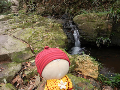
山上看印洲塘!!! 好美! 花老B 身後便是三椏村, 下山便是目的地.
J
Have a look @ Double Haven (Yan Chau Tong Marine Park)!!! So beautiful!! Sam A village is @ back of Tachibana san, also our "target" today.


到了三椏村了!!!
J
Here we are @ Sam A village!!!


先往荔枝窩方向, 中途經過農莊~ 然後去合益蜂場吃飯(客家菜), 這裡也有素菜!!! 是炆南瓜!!! 蜂場的大狗非常好奇, 常伴大家左右.
J
We walked to the direction for Lai Chi Wo first, for a lunch @ Hap Yik Bee Farm (Hakka cuisine). You'll see there's an organic farm nearby.
Today, we ordered veg. food from the bee farm~~ braised pumpkins!!!
The big dog from the bee farm was so curious and stayed with us together.


美如仙境的三椏灣旁留影. 三椏灣又名香港小桂林, 可想而知其景色多美麗.
J
Photos @ Sam A Bay, a place as beautiful as paradise. This place is part of the Yan Chau Tong (Double Haven) Marine Park, it's famous for its beauty,
also is called "Mini Guilin of HK"


三椏灣及三椏村濕地
J
Sam A Bay and the wetland of Sam A village~ wonderful scenes!!


是日重陽, 亦是祭祖之日. 在山上遊蕩時, 不斷聽見有燒炮竹的聲音. 在山路上有炮竹的痕跡 (在香港是不能燒炮竹的, 但圍村人在特別節日仍保留燒炮竹的習慣, 不過在市區則一定
不可以了), 亦撒滿了一地的紙錢. 遠望吊燈籠, 居然在冒煙???? 山火???? 非也!!
原來是後人燒衣時發出的煙霧.
古時, 燒炮竹是用作驅走邪氣和山川的障氣 (因為山上濕氣大), 而紙錢則是給那些山精妖怪, 令牠們不會騷擾先人... 不過, 山精妖怪也用錢購物嗎???
J
It was Chung Yeung Festival today, which is an important day for Chinese people. People go to worship their ancestors, together with hiking.
The legend behind is, there was a person in the past, advised by a fairy, to go uphill for escaping from a disaster in his village. So this man brought his family and went uphill.
When he was back, he found that all the animals in his village were dead.
From this legend, Chinese people believe that, during Chung Yeung Festival, going up the hill for a hike can bring you good luck and free from disasters.
There was paper money along the road, which was used to "bribe" the spirits living in the mountains NOT to disturb the dead in the tombs nearby. But do those "spirits" do
any shopping???
Looking from the ground, we could see there was smoke @ Mount Tiu Tang Lung, mountain fire????
NO, the smoke was coming from the burning of paper goods by the "tomb-sweepers", and we could also see burnt fireworks along the road.
(There were old sayings about "lighting up" fireworks to cast away the devils in the forests).
Playing with fireworks is not allowed in HK, but during some important festivals, local village people in the NT still will do so in their own land. (there are still some local village
rules from the past)


離開三椏村, 經苗三古道返回烏蛟騰. 中途經過風景優美的三椏涌濕地.
J
We left Sam A village and back to Wu Kau Tang via Miu Sam Path. We stopped for a while @ Sam A Chung wetland, a wonderful place for photos.

在路上忽然下雨!!! 這時剛好在最大的河流旁邊!!! 上有濕滑又傾斜的岩石, 大家步步為營, 一步一驚心. 幸好雨勢不大, 順利步過岩壁.
J
It started to rain suddenly when we were just next to the Biggest river!!! There are layers of slippery and steep rocks under our feet as we were passing by!!
We had to take great attention when walking on the rocks. Luckily the rain was not heavy, so we finished this part very quickly.


經過上苗田及下苗田時, 雨勢未減, 大家過河時都小心奕奕, 以防滑倒掉入河中變水鴨.
J
The rain still hadn't stopped when we were crossing the rivers @ (Upper) Sheung Miu Tin and (Lower) Ha Miu Tin.
We walked very slowly with care, to avoid falling into the rivers and got wet and dirty.


最後穿過陰暗的森林及濕地, 離開烏蛟騰.
J
Finally we walked through a dark forest and a piece of wetland and left Wu Kau Tang.


從烏蛟騰經山路步向新娘潭燒烤場, 乘巴士回大埔火車站 (烏蛟騰回大埔的小巴要 2 小時才有一回!!!!)
J
We walked via a mountain path from Wu Kau Tang, and then went to Bride's Pool BBQ site. From there, we took a bus back to Tai Po Railway Station.
(There's a minibus from Wu Kau Tang to Taipo Railway Station every TWO hours!!!! We were so tired to wait for another 2 hours!!!)
沒有留言:
張貼留言