2014年2月3日

20140203-Amah-Rock

馬年一登望夫石
A visit to Amah Rock

(大圍火車站 F 出口[在往紅磡月台上]→美田路→田心村→紅梅谷路→獅子山郊野公園→望夫石)
(Exit F of Tai Wai Railway Station [@ the platform for Hung Hom] →Mei Tin Road→Tin Sum Village→Hung Mui Kuk Road→Lion Rock Country Park→Amah Rock)

Album:

http://www.fotop.net/medalene/03feb14AmahRock?page=1

http://www.fotop.net/medalene/03feb14AmahRock?page=2

http://medalene.blogspot.com/2014/02/20140203-amah-rock.html


由於昨天的大浪西灣大長征實在太累, 今天只來一個小登山 --- 香港有名的景點, 望夫石!!!! 要以最短路程步上望夫石, 先從大圍火車站 F 出口起步 (F 出口位於大圍站, 往紅磡方向的列車月台上, 要花一點時間才能找到), 然後沿美田路向田心村的方向走. 看見行人天橋後, 登上行人天橋向田心村方向走回地面, 便是田心村. 在田心村旁有另一座行人天橋, 經天橋過馬路, 然後會看見行車路. 行車路旁便是紅梅谷路, 沿紅梅谷路走, 很快會看見世界花園的巴士站及山上的望夫石. 在此地走過對面往市區方向的巴士站, 站旁有供路人過馬路的位置, 再一次過對面, 便是獅子山郊野公園的入口. 由於路上沒有任何指示牌, 加上紅梅谷路交通極為繁忙, 要找到入口可能要花一點時間.... 不過如果不依交通燈的指示走出馬路找折徑, 被汽車或巴士壓扁的機會相當高!!
We had a short walk for one of HK's famous spots today ~~ Amah Rock!!! (A big rock looks like a woman with a baby on her back) Now, let's take a look how we get to Amah Rock on foot. Started from Exit F of Tai Wai Railway station (please note that Exit F is located on the flatform of Tai Wai Station, the way for Hung Hom, you may need to take a few minutes more to find this exit), we walked along Mei Tin Road to the direction for Tin Sam. We could see a pedestrian flyover nearby, so we went up and walked down to Tin Sam Village, which is on the ground. Then we crossed the road via another pedestrian flyover next to Tin Sam Village. Oooops, sounds complicated?!! Hahaha!!! Now we could see the traffic road and we just walked along this traffic road -- Hung Mui Kuk Road. After 1-2 minutes' walk, we could see Amah Rock @ the hilltop and the bus-stop for "Worldwide Gardens". Yep, from there, we crossed the road for another bus-stop at the opposite side (this is the way for Lion Rock Tunnel). And finally we crossed the road again and now we arrived @ the entrance of Lion Rock Country Park. YEAH!!!! Never try to find a short-cut getting to the entrance, or you may be run over by the cars or buses here.


看到上山往望夫石的指示牌, 很快便到了.
Now just follow the direction signs for Amah Rock, it takes you a short while for the hilltop.


到了望夫石!!!! 比想像中巨大, 近看完全不像一個背著嬰兒的女人, 反而像一個背著背包, 累壞了的登山客!!!
Here we are @ Amah Rock!!! It is much bigger than you think, and it doesn't look like a woman with a baby any more. It looks like a tired backpacker!!!


望夫石旁的猴子王.
Monkey King was looking for food near Amah Rock for the whole morning.


2014年2月2日

20140202-Tai-Long-Wan-Hiking-Trail

新春郊野行大運 --- 大浪西灣至土瓜坪漫漫長路遊
Long Hike on CNY -- 12km trail from Tai Long Sai Wan to To Kwa Peng @ Sai Kung

(西貢親民街麥當奴門口→29R 村巴→西灣亭→西灣村→大浪西灣→鹹田灣→蚺蛇尖山腳→赤徑→土瓜坪→巴士回鑽石山)
(Chan Man Street of Sai Kung→@ McDonald's restaurant→Village bus no.29R→Sai Wan Pavilion→Sai Wan Village→Tai Long Sai Wan beach→Ham Tin Beach→The bottom of Sharp Peak→Chek Keng→To Kwa Peng→Back to Diamond Hill)

Album:

http://www.fotop.net/medalene/02feb14TaiLongTrail?page=1

http://www.fotop.net/medalene/02feb14TaiLongTrail?page=2

http://www.fotop.net/medalene/02feb14TaiLongTrail?page=3

http://www.fotop.net/medalene/02feb14TaiLongTrail?page=4

http://www.fotop.net/medalene/02feb14TaiLongTrail?page=5

http://www.fotop.net/medalene/02feb14TaiLongTrail?page=6

http://www.fotop.net/medalene/02feb14TaiLongTrail?page=7

http://www.fotop.net/medalene/02feb14TaiLongTrail?page=8

http://medalene.blogspot.com/2014/02/20140202-tai-long-wan-hiking-trail.html


是日初三赤口, 不宜拜年, 宜遠足行山. 所以大清早便在西貢親民街的麥當勞門外排隊, 登上 29R 村巴, 向西灣亭進發. 從西灣亭下山, 很快便到了西灣村, 途中還看見美麗的萬宜水庫.
Today is the 3rd day of the FIRST month according to the Lunar calendar. It is a bad day to give a visit to your relatives, because Chinese people strongly believe that if you visit your relatives on this day, you will start a quarrel with them. So people usually go to temples for worshipping, or go for hikings on this day, which may bring you good luck for the whole year.
We arrived McDonalds Restaurant @ Chan Man Street, Sai Kung early this morning, and then queued up for a village bus no.29R there. As we had expected, the queue was very long. Luckily the bus came in less than 20 minutes, we all arrived Sai Wan Pavilion very early. Started from Sai Wan pavilion, we went down to Sai Wan Village in less than 30 minutes, and we also had a look @ the beautiful scenes of High Island Reservoir.


到了大浪西灣, 大家在海邊的茶座以清甜豆腐花作為早餐!!!! 突然海邊發出巨響...!!! 原來有直昇機在海灘著陸!!!! 果然有趣!! 早餐後在大浪西灣海灘稍為一走, 然後便上山往鹹田方向出發.
We had tofu pudding @ a sea-side cafe after we reached Tai Long Sai Wan. Suddenly we heard strange noise from the beach. Oh!! A helicopter just landed!!!! (NOT UFO!!!) So interesting, I wonder who was travelling here by a helicopter????? Hahaha!!! We had a short walk along the beach after the breakfast, and then we started to go uphill for the next spot --- Ham Tin Beach.


經過堤防, 可一賞大浪西灣的美態.
Walking via the dike and we had a look for the panorama of HK's backyard --- Tai Long Sai Wan.


經麥理浩徑上山, 全部都是易走的石屎路, 沿途充滿美景, 不來一遊真的是遺憾!!!
We walked uphill via MacLehose Trail (Stage 2), the whole trail is made up of very hiker-friendly concrete footpath, together with 100% beautiful seaview and mountain view, a regret if you don't come here for a walk!!


山中有日昝!!!
A sun dial on the road.


在山上的西灣營地遇上牛母子!!!
We met a cow and her cattle near Sai Wan camp site along the footpath.


遠望蚺蛇尖 --- 山頂斜得嚇壞人!!!
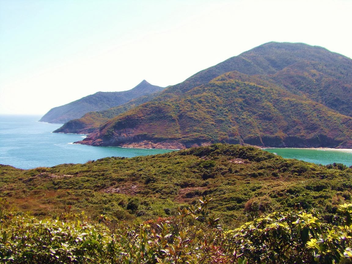
Sharp Peak --- the summit is so sharp and steep!!!!!


到處是迷人美景!!!!!
Beautiful scenes around us!!


看到鹹田灣了!!!!! 好美!!!
Now we could see Ham Tin Beach!!! What a wonderful place!!!!


下降鹹田灣.
Just landed on Ham Tin Beach.


踏著粗糙的木板橋穿過濕地, 小心慢走, 否則隨時跌入水中.
We queued up and crossed the wooden "bridge".... a bit worried that we might fall into the swamp.


在海邊茶室稍作休息.
Had a rest @ the seaside cafe of Ham Tin.


由海邊茶室後面的村路續走, 經過鹹田圍再前進!
We continued our walk from the path @ the back of the seaside cafe, via Ham Tin Wai to Pak Tam Au.


向北潭凹方向進發.
Keep on going to Pak Tam Au.


途中經過大浪村(大圍), 此地亦有食店, 還有一所小小教堂.
Now we walked via Tai Long Village (Tai Wai), there are 2 food stalls here, with an old little chapel.


全港最尖最斜的蚺蛇尖就在眼前!!!!!!! 看看向山頂挑戰的勇士們, 大家都要手腳並用才能攻頂!!!!
Now we could see the sharpest peak in HK --- Sharp Peak. Have a close-up of it, see how hard the hikers were trying to climb up for the hilltop!!!!


途中有涼亭, 旁有蚺蛇尖的簡介及上山的路.
There is a pavilion on the road, with a signage showing the details of Sharp Peak. The footpath for Sharp Peak is nearby.


上行往蚺蛇尖的路, 已可看到大量美景, 但要上山頂則要做好安全準備及量力而為, 因為登頂的確有難度, 不要勉強.
We tried to walk up via the path for the summit of Sharp Peak --- beautiful scenes everywhere, but it is very challenging if you continue the walk for the hilltop. The ground becomes very gravelly and steep as you go up, get well-equipped before the attempt!


續向北潭凹方向前走, 很快到達赤徑.
We kept on walking to Pak Tam Au, then we stoppped for a while @ Chek Keng, a beautiful place with lots of wetlands. You can still see Sharp Peak from here!


最後一站--- 土瓜坪!!! 內有大量濕地和荒廢村落, 從廢村下山後, 經過村口的斜坡(往黃石碼頭的山徑旁)可步往巴士站.
The last spot -- To Kwa Peng!! With lots of wetlands and abandoned village houses, walking down to the pier, you can find a steep village path (next to MacLehose Trail for Wong Shek Pier) which is leading to the bus-stop.